Peregrine Geography

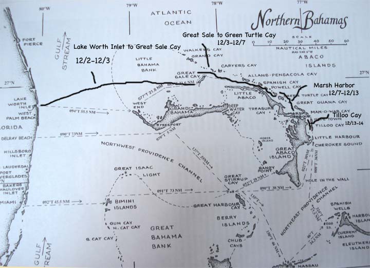
A month ago, I included an update on the geography of our travels which was followed by at least one request that I do so more often. So today I am attaching two maps which outline the trip down the Intracoastal Waterway from 10/25 'til 12/2 and another chart describing our early movements in The Bahamas.
posted by Voyage of the Peregrine at 10:01 AM
![]()
![]()

<< Home